A spatial database of Melbourne’s streams and rivers:
their flow-paths, names, catchment boundaries and environmental attributes
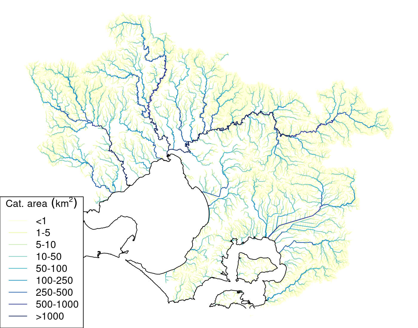
The Melbourne Stream Network database is a systematic collection of hydro-environmental characteristics of streams and rivers of the Melbourne Water (Victoria, Australia) region (catchments of Western Port and Port Phillip Bay east of Little River, covering an area of 12,900 km2). The stream lines are an accurate representation of hydrologically connected flow paths, derived from 1-m LiDAR. All 35,589 streams have unique names (and 3-character stream codes), corresponding to their recognized names where known. The stream lines are divided into 131,298 reaches (sites), each with a subcatchment boundary derived from a 5-m digital elevation model. The database contains a wide range of environmental characteristics for each reach.
Each subcatchment/reach has a next downstream site value (nextds) which permits upstream-downstream network calculations, following the logic used by larger-scale datasets such as the Australian Geofabric (Stein, Hutchinson, and Stein 2014) and the global HydroSheds database (Linke et al. 2019). This database provides more accurate and finer-scale representations of flow paths, catchment boundaries and environmental characteristics than the larger-scale datasets. The database includes tables and fields that allow rapid whole-network calculations.
For more information, including tips on using the data, see the Technical details tab, and Walsh (2023) linked therein.
You can download the full network data from the data downloads tab.
Alternatively, you can interact directly with the network data using the stream explorer app, and download the catchment boundary and available environmental data for any selected reach.
If you have locational data for site locations in the stream network, you can generate standardized sitecodes and download environmental data for the sites using the reach/site stats app